
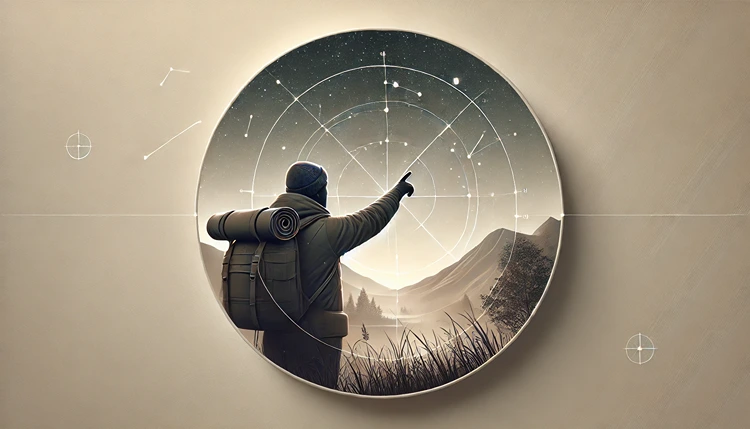
Getting lost in the wilderness can feel intimidating, especially without a compass. But nature provides plenty of clues to help you find your way, and with a little practice, you can learn to use stars and natural landmarks as reliable navigational tools. From following the North Star to using mountain ridges and rivers, the outdoors offers countless ways to guide yourself. Let’s go through some of the most practical tips for natural navigation, from reading the stars above to understanding the landmarks around you.
How Can Stars Help You Find North?
One of the simplest ways to find your bearings at night is by locating the North Star. This star has been used for centuries as a guiding light because it almost directly aligns with Earth’s axis, meaning it always points north in the Northern Hemisphere. While other stars rotate around the sky, the North Star remains relatively still, making it a reliable point of reference.
Steps to Find the North Star
- First, locate the Big Dipper constellation (also known as Ursa Major). It resembles a large spoon or ladle in the sky.
- Identify the two stars on the edge of the “bowl” of the Big Dipper, known as the “pointer stars.”
- Draw an imaginary line extending from these two stars, and follow it up to the next brightest star. This will lead you to the North Star, or Polaris.
- Once you’ve identified the North Star, you’ll know that you’re facing north.
Helpful Hint:
Don’t worry if you can’t find the North Star right away. Practicing under different skies and times of year will make it easier to spot.
Using the Southern Cross to Find South (Southern Hemisphere)
For those in the Southern Hemisphere, finding south without a compass requires a different approach, since Polaris isn’t visible from that side of the planet. Instead, the Southern Cross, a small but distinctive constellation, can guide you. While it’s smaller than the Big Dipper, it stands out in southern skies and provides a reliable direction indicator.
Locating the Southern Cross
- Find the constellation known as Crux, or the Southern Cross. This is a cross-shaped constellation that can be found in the southern sky.
- Imagine a line extending from the longer part of the cross. Continue this line downward until you reach a point about four and a half times the length of the cross.
- Drop straight down from this point to the horizon—that’s roughly south.
While it may take some practice, learning to identify the Southern Cross can give you a solid point of reference if you’re venturing out in Australia, South America, or other southern locales.
What Landmarks Can Help with Navigation?
Besides stars, natural landmarks around you can serve as valuable guides. Mountains, rivers, and even vegetation can provide direction if you know what to look for. Here are a few ways you can make use of these natural markers.
Using Mountain Ridges and Peaks
If you’re in a mountainous area, ridges and peaks can give you a good sense of direction. Generally, mountain ranges extend in a specific direction (often north-south or east-west), so paying attention to the angle and alignment of mountain peaks can help you orient yourself. Many maps include mountain ranges as points of reference, so check any maps you have beforehand to see if they align with your surroundings.
Helpful Hint:
Notice if vegetation changes on one side of the mountain ridge. This can give clues to wind directions and exposure to sunlight, which varies depending on orientation.
How to Use Rivers and Streams for Direction
Rivers and streams can often be a reliable guide, as they generally flow from higher to lower ground. In many places, rivers will eventually flow toward a larger water body like a lake or ocean. By following a river downstream, you may find it leads you to civilization or at least a better-known area.
Guidelines for Following a River
- Determine the flow direction by observing which way the water is moving.
- Follow the river downstream if you’re lost; it will usually take you to a larger body of water or a settlement.
- Remember to stay hydrated and avoid overly fast-moving sections of the river.
In case the river forks, consider the landscape around each branch. Lower ground might lead you to larger water bodies, which can be useful if you’re trying to find populated areas.
How Vegetation Can Guide You
Plants and trees also offer clues about direction. For example, in many areas, trees tend to have denser foliage on the side facing the sun. In the Northern Hemisphere, that means more growth on the southern side, while in the Southern Hemisphere, it’s generally on the northern side. You can also observe moss growth—though it’s not a foolproof indicator, moss typically prefers shaded, moist areas, often on the north side of trees in the Northern Hemisphere.
Identifying Direction with Tree and Plant Growth
- Look at tree branches and foliage to see if one side has more growth.
- Check for moss and lichens, which may indicate the shaded, usually northern side in the Northern Hemisphere.
- Compare with other trees in the area to get a clearer sense of direction.
Plants alone shouldn’t be your sole navigational guide, but combined with other natural cues, they can help you make more informed decisions about direction.
Using Shadows and the Sun
If stars aren’t visible, you can use the sun to get your bearings during the day. A simple way to do this is with a shadow stick, which can provide a rough directional guide by observing the movement of the sun and shadows.
Making a Shadow Stick
- Find a straight stick or branch and plant it upright in the ground.
- Mark the tip of the shadow with a small stone or another marker.
- Wait 15–30 minutes and mark the tip of the shadow again. The line from the first mark to the second will roughly indicate the east-west axis, with the first mark being west and the second being east.
This method can be an effective way to determine direction, particularly in open areas where other natural landmarks might be sparse.
Advanced Star Navigation Techniques
Once you’ve gotten the basics down, you can take star navigation a step further by learning to recognize additional constellations and using them for directional guidance. Some constellations are visible year-round, while others appear seasonally, so knowing what’s overhead based on the time of year can improve your accuracy. This is especially helpful when traveling long distances over multiple days or if cloud cover partially obstructs the night sky.
Using Cassiopeia to Confirm North
Another useful constellation for finding north is Cassiopeia, which is shaped like a “W” or “M” depending on its position in the sky. Cassiopeia is opposite the Big Dipper in the sky, making it a good backup for locating the North Star on nights when the Big Dipper is harder to see.
- Find Cassiopeia by looking for its distinctive “W” shape in the northern sky.
- The North Star lies between the Big Dipper and Cassiopeia, so if you can see Cassiopeia, you can confirm your orientation toward the North Star more easily.
This approach is particularly useful when you have partial visibility of the sky, as seeing either Cassiopeia or the Big Dipper allows you to locate north.
Common Constellations and Their Navigation Purposes
| Constellation | Seasonal Visibility | Direction Indicated | Notes |
|---|---|---|---|
| Big Dipper (Ursa Major) | Spring and Summer | Points to North Star | Visible in the Northern Hemisphere; use pointer stars to locate Polaris. |
| Cassiopeia | All year in Northern Hemisphere | Confirms North Star’s position | Opposite Big Dipper, helps verify Polaris location. |
| Orion | Winter | East-West orientation | Visible across both hemispheres; belt aligns roughly east-west. |
| Southern Cross (Crux) | All year in Southern Hemisphere | Indicates South | Best for Southern Hemisphere navigation; extend line from longer part of cross. |
| Scorpius | Summer | East to West movement | Seen mostly in Southern Hemisphere; useful for orientation at night. |
Using the Moon to Estimate Direction
The moon can also be a helpful guide, especially when it’s close to a full moon and provides enough light to cast shadows. While the moon’s position changes throughout its cycle, you can still use it as a rough directional tool.
Finding Direction with the Moon’s Phases
The moon’s phases offer some clues about direction. Generally speaking:
- If the moon rises before sunset, the bright side will be in the west.
- If the moon rises after midnight, the bright side will be in the east.
By observing which side of the moon is illuminated, you can make a rough guess about which direction you’re facing. However, the moon’s orientation can vary depending on the hemisphere, so it’s a less precise method compared to using stars. Still, in combination with other natural signs, it can be a useful backup.
How to Use Clouds and Wind Patterns for Navigation
Cloud formations and prevailing wind directions often provide clues about weather patterns and, by extension, orientation. While these signs can’t give you precise direction, they can help you confirm or refine other navigational cues.
Reading Clouds for Direction
In many regions, clouds tend to follow specific directional patterns based on prevailing winds. For instance, in temperate zones, clouds often move from the west due to prevailing westerlies. Observing cloud movement over time can give you a sense of east-west orientation.
Using Wind Patterns
- Prevailing winds often blow from specific directions based on geography. For instance, in the United States, winds often come from the west.
- By observing wind direction consistently over time, you can get a rough sense of direction, especially in open areas like plains or deserts where landmarks might be sparse.
Keep in mind that local conditions can influence wind patterns, so while it’s a helpful guide, don’t rely solely on it for navigation.
How Animal Behavior Can Provide Directional Clues
Wildlife often follows specific paths and patterns that can indirectly indicate direction. While this isn’t as reliable as following stars or rivers, animals sometimes exhibit behaviors that help you interpret the environment more accurately.
Bird Migration Patterns
During migration seasons, birds often travel in a north-south direction. Observing large flocks moving along these axes, especially in early morning or evening hours, can give you a rough sense of direction. While this is mostly a seasonal observation, it can be handy if you’re trekking during these periods.
Animal Trails and Habits
- In many regions, animal trails tend to lead to water sources, which can be a helpful guide if you’re looking for hydration or a larger landmark.
- Observe paths made by animals like deer, which often run toward water sources. By following these trails, you might end up near rivers or lakes, which are useful for orientation.
While animal behavior isn’t a perfect navigational tool, it can provide clues about where you might find water, shelter, or even exit points from dense wilderness areas.
Tracking Time with the Stars and Sun
Knowing the approximate time of day can improve your navigation accuracy, especially if you’re trying to reach a specific destination or establish a route for multiple days. Ancient cultures used the stars to estimate time, and you can learn similar techniques to pace yourself on longer journeys.
Estimating Time with the Big Dipper
The Big Dipper rotates around the North Star, completing a full circuit every 24 hours. By observing its position relative to the North Star, you can estimate the time within a few hours. This is most effective if you have a general idea of the time already, as it requires some practice and familiarity with the night sky.
Using the Sun for Approximate Time
During the day, you can gauge time by observing the sun’s position:
- In the Northern Hemisphere, the sun is in the eastern part of the sky in the morning, directly overhead around noon, and in the west in the evening.
- Similarly, in the Southern Hemisphere, the sun follows a similar arc but with some regional differences depending on proximity to the equator.
Understanding these patterns allows you to make time-related decisions, such as knowing when to set up camp or continue traveling, based on available daylight.
Combining Navigation Techniques for Better Accuracy
Natural navigation works best when you use a combination of techniques. Stars, sun, landmarks, and animal patterns each offer unique benefits, but their accuracy improves when used together. For example, finding the North Star can give you a reliable north point, while following a river can lead you to resources and, in many cases, civilization.
Helpful Hint:
When you’re in an unfamiliar area, take note of as many natural cues as possible. Each clue adds to your understanding of the surroundings, making it easier to navigate confidently.
Navigation in the wilderness is as much about observation and patience as it is about direction. By honing your skills and combining techniques, you’ll be better equipped to find your way, whether traveling by starlight or sunlight.
Frequently Asked Questions
Wrapping Up
Using stars and natural landmarks as navigation aids adds a valuable skill to any outdoor adventurer’s toolkit. From finding north with the North Star to using local rivers and vegetation, these techniques provide alternatives to modern tools that deepen your connection with the environment. While these methods may take practice, they can be reliable when technology isn’t an option. Remember, the key to natural navigation lies in observation and patience. Mastering these skills equips you to confidently navigate most terrains, making every wilderness journey not only safer but also more fulfilling.